No bike ride for old men

Tuesday afternoon I decided to ride my mountain bike to my doctor’s office so they could scan my new insurance card. The map on my phone says it’s 13 mile to his office. I had done it once before a few years ago, so I thought it would not be too great a challenge. The difference was that back then I was riding a good bit, including up and down the mountain, and now I’m not. It has been around a year and a half since I got on either of my bikes, and at least a couple of months since I used our now-defunct stationary bike. The stationary bike is a poor substitute for actual riding anyway.

But still, I thought it would be a fun ride and would give me a chance to get some real exercise. It turned out to be that, and more.

The first mile and a half is down Fouche Gap Road to the bottom of the mountain. I flew. The next eight or so miles was on Huffaker Road and Technology Parkway, which have gentle ups and downs. That was not bad. I was rolling along pretty well in top gear most of the time.

The end of Technology Parkway is about a half mile from Summerville Park, where I grew up. I avoided my old street, which is now four lanes and fairly busy with hospital traffic, but I got a good look at houses I have seen only from a car for decades, except for that one previous bike ride to my doctor’s office. I took a sidewalk along Martha Berry Boulevard to avoid heavy traffic for about another half mile, and then turned into Fourth Ward, where my father grew up. I rode down to the levee, and then crossed the river into downtown.

I rode a few blocks down Broad Street, where it was easy to keep up with traffic. I turned down First Avenue, which has almost no traffic, and then it was a short hop to my doctor’s office.

I was sweaty but felt pretty good when I got there. It took about a minute for them to scan my insurance card, and then I went out to start back.

When I got back to Broad Street, I crossed the river on an old railroad bridge that has been turned into a walking and bike trail. It’s narrower than I expected.

rr_bridge

Some Romans have started putting love locks on the handrails. We don’t take the sad, little excuse for a local newspaper, so I haven’t heard whether city officials discourage it. If they do, it hasn’t worked.

lovelocks

Some people were rafting. That was a surprise, but I guess the rivers are clean these days.

rafters

You can still see the color difference between the Oostanaula and the Etowah rivers. The Etowah River used to run red with clay from an upstream mine, but today it’s just another shade of green, like the Oostanaula.

etowah_oostanaula

I have seen blue herons around here, but never on the river.

blue heron

I crossed the river, then went up the walking trail that runs along the levee.

riverwalk

Things were going pretty well when I got back to Summerville Park. I decided to take a look at the steep hill we dreaded when we rode from our house diagonally across the neighborhood to the little city park at the opposite corner. I rode down the hill, and then turned around to ride back up. The mountain has turned into a barely-noticeable bump in the road. It’s not the same one that I still have in my memory.

Back on Technology Parkway my recent lack of riding was catching up to me. With a little headwind, a slight climb, and temperatures in the upper 80’s, I was beginning to struggle. A couple of light showers helped, but I still had to climb Lavender Mountain to get back home.

That was the real struggle. Even in the lowest gear I was having trouble. I wasn’t out of breath, but my legs were really fatigued. I admit it – I had to stop several times to let my legs rest.

I finally made it back home, where I hobbled around with sore quadriceps. I was also dehydrated. A couple of ibuprofens, an ice-cold beer, some orange juice and a bowl of ice cream helped. As did a good night’s sleep.

Wednesday I was fine – not even a sore muscle. I did learn a couple of things. First, I’m not as young as I used to be, and second, I need more time on the bike before I do that again.


A glory at Kwaj

In about 1987 I had a chance to travel to Kwajalein Atoll in the Pacific Ocean. Kwajalein Atoll is part of the Republic of the Marshall Islands. It’s about 10 degrees north of the equator and about 13 degrees on the other side of the International Dateline (the US government stretches the dateline west to include Kwajalein in the same date as the mainland US). It’s 2500 air miles from Hawaii, which is about 2400 air miles from Los Angeles, which is just under 2000 air miles from Atlanta. It is, in other words, remote.

The US has operated a base on Kwajalein Island since the end of World War II US Army Kwajalein Atoll, or USAKA). They also operate bases on other islands in the chain, including one called Roi-Namur.

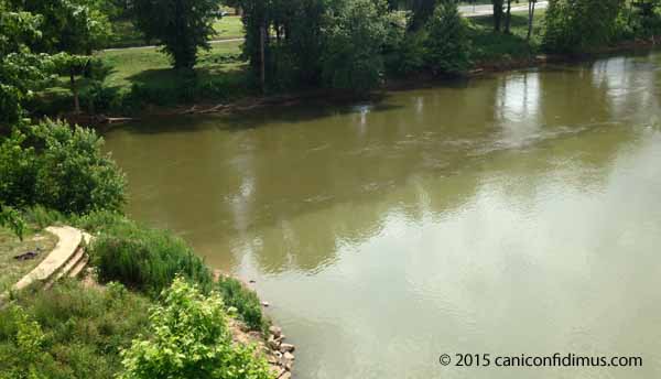
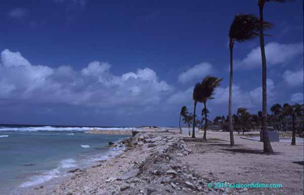
I took this picture when I flew from Kwajalein to Roi-Namur (Roi and Namur were originally two separate islands, but they were joined by an artificial causeway by the Japanese during World War II.)

theatoll

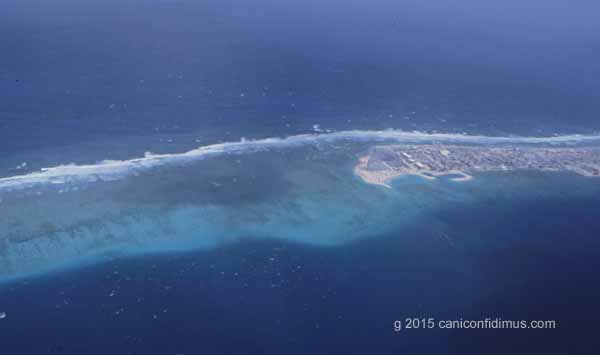
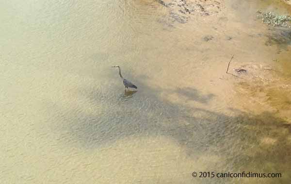
Here is another I took on the same flight.

glory2

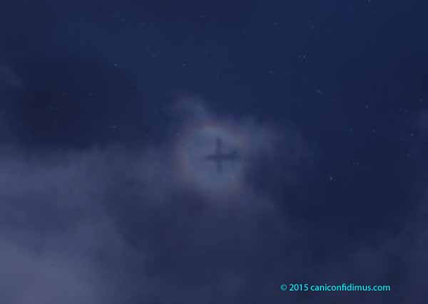
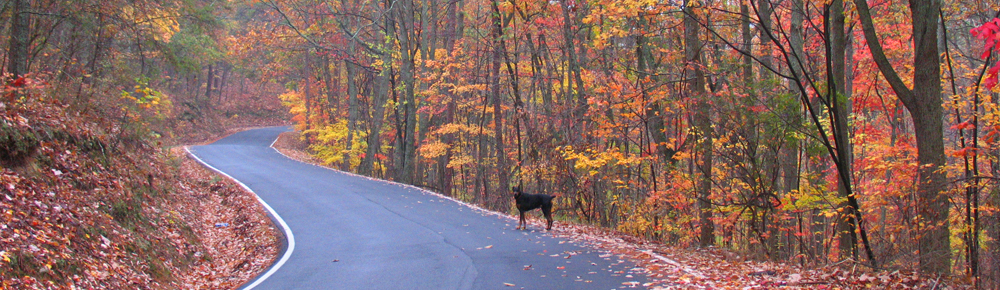
This is a glory. This is not an especially good example, but any example of a glory is a wonder. A glory is a bright ring that forms around the shadow of an observer when the sun is behind the observer and the observer looks towards his own shadow. Glories can often be seen from airliners flying over clouds, or in fog with bright lights behind the observer. I showed a glory in fog in a previous post, although I didn’t actually identify it as a glory. You might also see a glory in smoke.

The Wikipedia article on glories indicates that there is some scientific uncertainty about the source of the phenomenon, but other sources indicate a fairly simple explanation that I think is accurate. It is basically caused by scattering of light by cloud drops or other particles in the air. In the case of most particles or droplets, most of the light that interacts with them is scattered in the same general direction as it was originally traveling. That’s why, when clouds cover the sun or moon, you can see a bright area around where the sun or moon is, as long as the clouds aren’t thick enough to completely block the light. However, a large portion of the incident light is scattered back towards the source. That’s what causes the bright ring around the observer’s shadow. Back scattering, as it’s known, is what makes it hard to see in thick fog if you use your car’s high beams.

The (relatively) simple explanation is also consistent with the fact that you can see a similar phenomenon on a sunny day if you look at your shadow on the ground. There should be a brighter area on the ground surrounding your shadow. That bright area is light that is preferentially scatted back towards the light source.

The Wikipedia article about Kwajalein Atoll has at least one mistake. It says that the total area of the atoll islands is about 16 square miles, when it is, in fact, about six square miles. They may have been referring to the total area of the Marshal Islands, which includes other atolls.

The Marshall Islands are probably most famous as the site of a lot of the US atmospheric nuclear weapon testing.

Kwajalein Atoll is now used by the US Army as a missile and missile defense test site. The current name of the site is the Ronald Reagan Ballistic Missile Defense Test Site (usually called simply the Reagan Test Site, or RTS), named in honor of President Ronald Reagan because of his pursuit of the fantasy of a defense against a large-scale missile attack on the United States.

More than 70 years ago, in 1944, US forces invaded Kwajalein and Roi-Namur as part of the strategy of island-hopping across Pacific on the way to the Japanese homeland. Kwajalein was invaded a few months after Tarawa, which was the first really bloody lesson the US learned about what fighting the Japanese would be like. The planners for the Tarawa invasion thought they had bombed and shelled the island so much that there would be little resistance; that turned out not to be the case. So when they planned the amphibious invasion of Kwajalein, by one estimate, they poured about 6000 tons of bombs and shells onto the island. That’s equivalent to about 40 percent of the size of the atomic bomb dropped on Hiroshima. Another estimate was that it amounted to about 100 pounds of explosives per square foot of the island.

The battle for Kwajalein Island lasted four days. It’s pretty amazing to think about, especially if you have actually visited that island. At almost any point it’s possible to see the ocean on both sides at the same time. Back then I was still running; it was an easy run around the entire perimeter of the island.

The invasion of Roi-Namur occurred next. That island is tiny, even in comparison to Kwajalein Island. That battle took a day. As a result of that 24 hours of fighting, four Medals of Honor were awarded.

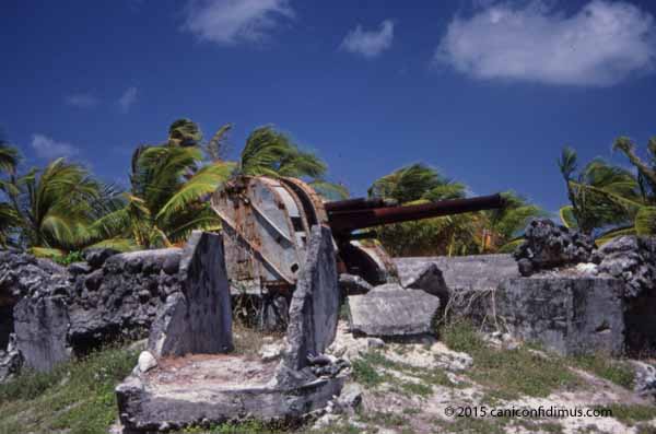
There are quite a few relics from the Japanese occupation and the US invasion. Here is a Japanese headquarters building.

japanesebuilding

This is what’s left of one of the Japanese defense positions.
gunmount

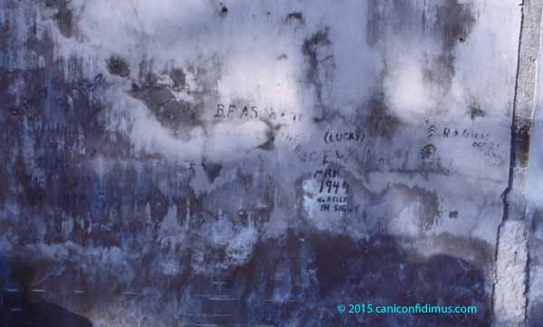
This is a wall of a building with graffiti left from that time.

graffitiwall

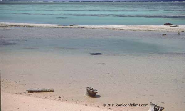
This is some of the debris left from US equipment lost on the beach. I found some old rifle cartridges in the water near Roi, but have long since lost them.

invasiondebris

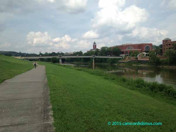
Today, the islands are pretty.

islandpalms

windypalms

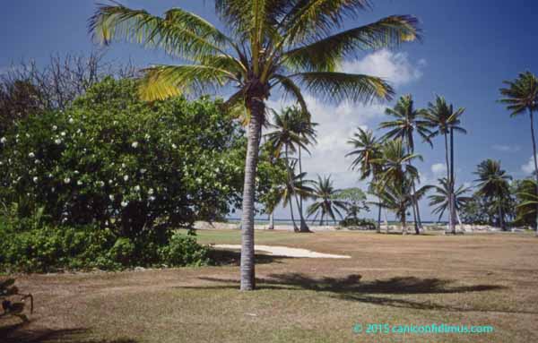
Base personnel cut the coconuts down from the trees to keep them from falling onto the heads of residents.

It’s not what you think of as a tropical paradise, but that image probably comes from volcanic island rather than coral atolls. Coral atolls have no mountains. The highest natural elevation on Kwajalein is probably less than six feet above mean sea level. Fortunately for Kwajalein, it is close enough to the equator that hurricanes almost never hit the island. However, when I was there, a strong storm had only recently hit the islands, resulting in a lot of losses for the Marshallese. Kwajalein’s and Roi’s facilities weren’t harmed, but those facilities are American and more sturdily built.

Kwajalein Island and Roi-Namur Island are reserved for US personnel. Any Marshallese working on the islands must return back to their home islands after each work day.

The reason US personnel are at USAKA is to take part in US missile testing. US intercontinental missiles are sometimes launched from the coast of California to reenter at Kwajalein as part of routine testing of US offensive weapons. Personnel at Kwaj also take part in missile defense testing. This is used for both purposes.

altair

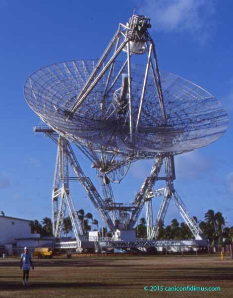
This is ALTAIR (ARPA Long-Range Tracking and Instrumentation Radar), operated by MIT Lincoln Laboratory. ARPA is the Advanced Research Projects Agency, which is currently called the Defense Advanced Research Projects Agency, or DARPA. There are other radars located around the islands.

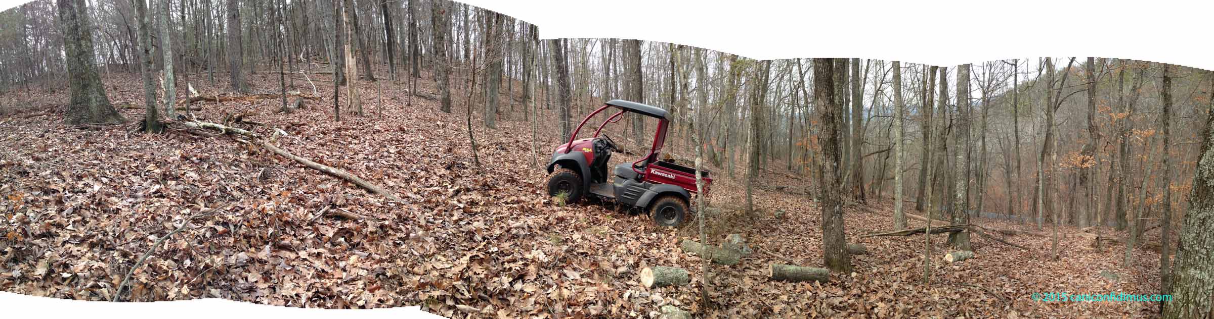
My visit was part of a small sounding rocket test associated with the old Ballistic Missile Defense program, the one that was going to protect the US from a massive Soviet missile attack. I flew into Kwaj one day and then flew with a few of my fellow contractors and some government workers to the island of Roi-Namur. I stayed at Roi for a few days before the missile test I was involved with. It was a nice vacation. I spent it walking around the island, reef walking and taking photographs (the slides from which the images here are scanned). The weather was warm and humid but reasonably pleasant. The facilities on the island are pretty primitive in some respects. It was at Roi that I learned that if you don’t keep Diet Coke cool, the Aspartame in it breaks down into something that doesn’t taste very good. At all.

Our test, which was a small one, failed. It involved what’s called a sounding rocket, which is a smallish missile that barely reaches outer space and then returns. Our missile had three stages. When the first stage separated, it “chuffed” (residual propellant ignited and puffed out). When it chuffed, the first stage bumped into the second stage and damaged it. The missile then went out of control and had to be destroyed.

So we packed up and went back home, and I never went back again.

I broke the bike

When I was still working I used to ride my bicycle in warm weather, when the days were long enough that I could wait for the afternoon rush hour to end. There was a good loop in Cummings Research Park, where I worked, so I waited until around 6 pm and then rode 20 miles. On weekends at home I rode down the mountain one way or the other. Sometimes I rode the loop that the Fouche Gap Road Race used last Saturday. Other days I rode in towards town on Huffaker onto Technology Parkway (a grand name without much to back it up). But when the days got shorter and the weather got colder, I stopped riding outside.

We had bought a NordicTrack stationary bike a few years ago, but I didn’t use it much. Then, when I was diagnosed with cardiomyopathy almost two summers ago, I decided to get more serious about it. I figured if my heart was going to get lazy, I was going to push it a little and see what happened. So I started riding about 50 minutes almost every day. Sometimes on Wednesdays I skipped the ride so we could go to our favorite Mexican restaurant for huevos rancheros for lunch, but most of the time I rode.

I wore out the belt that runs from the pedal crank to the resistance mechanism. That was no big deal; I was able to get a replacement for that.

And then a few weeks ago there was a crunch from the innards of the bike, and then no more resistance. I thought I might be able to repair it again, so I tore the bike apart and eventually discovered this.

bearing2

This is an iron alloy pulley that attaches to the resistance mechanism shaft and is turned by the belt I replaced that runs to the pedal crank. Like a typical bicycle rear wheel hub, the stationary bike has a one-way clutch that engages the resistance mechanism when the pedal is turned, but freewheels when the pedal is not being cranked. If you look closely at the picture, you can see that the pulley has a crack completely through. What you may not be able to see is that the clutch mechanism has disintegrated. It’s on the inside, between two sets of roller bearings. The clutch mechanism was made from plastic. I might be wrong, but it looks like it had little plastic teeth that gripped one way but slipped the other. I assume that the plastic clutch mechanism broke because the pulley cracked and released the pressure that supported the clutch.

OK, I thought, maybe I can get a new pulley. So I went online and found a parts diagram with prices for almost every part in the bike. There was an identification number for the pulley, but no price for it. I emailed the service department to ask whether the pulley was available as a separate replacement part. The answer was that I would have to buy the entire resistance mechanism. Sorry.

That wouldn’t be a big deal, except that the resistance mechanism costs about twice what the entire stationary bike costs. It’s more than $800.

I was pretty disappointed with NordicTrack. Iron is a pretty strong material. Steel pulley wheels on automobile engines almost always last for the lifetime of the engine. I probably used the bike more than a typical buyer, but still, I doubt that I actually wore it out. I thought a failure of this type would almost certainly be a manufacturing defect, so I emailed the photo to my brother, who was a materials scientist in a previous lifetime (now he’s a Presbyterian minister). He said it seemed pretty clear that the crack started on the outside of the pulley and propagated inwards. He also thinks the cause was a defect either in machining or possibly in casting.

In the meantime, I started using a rowing machine I bought about 25 years ago and almost never used. I row for about an hour pretty much every day. Leah is also rowing; she’s at about 30 minutes and climbing. Unfortunately, I don’t think I’m getting as much benefit from the rowing machine as I did from the bike. The bike had a calorie display, which could, at least in principle, be pretty accurate, so I had a good idea of how much work I was doing. The rowing machine does not, but based on how I feel using it, I think it’s considerably less energy intensive.

Riding the bike and rowing are both pretty boring. I watch television as I exercise, but with the rower, I can’t flip channels without stopping. Even with satellite, it’s hard to find anything interesting to watch, especially in the daytime.

My brother wants me to keep the part so he can look at it the next time he comes down from Chattanooga. It is an interesting failure, if you want to look at it academically. I don’t much.

I will probably end up buying another stationary bike. I don’t know what type to buy. NordicTrack seems to have a reasonably good reputation, or at least name recognition, but I would hate to buy one and then have the damned thing break again.

Bikes across the gap

The Fouche Gap Road Race for bicycles was held Saturday. The race started about five miles back towards town, came out Huffaker Road and then up Fouche Gap Road. The course descended the back side of the mountain into Texas Valley and then looped around Rocky Mountain, in the center of the valley. Depending on the category of the rider, the course looped from one to three times and then climbed back up to the finish line at Fouche Gap. The total mileage was 28 to 81 miles depending on how many loops were ridden.

I did not ride. I did, however, walk down to finish line at the intersection of Fouche Gap Road and Lavender Trail to see some of the bicyclists finishing. The junior and female riders took the shortest course so they finished first.

bikes and bikes

A very nice BMW motorcycle accompanied the riders up the back side of the mountain to the finish line.

I walked down to the gap about 20 minutes before the first riders finished, so I spent the time talking to the wife of one of the racers and petting their dog. She expected her husband to finish a good bit after the first finishers since he was riding the two-lap course.

There was not a huge crowd at the finish line; of course it wouldn’t take many cars and people to make a huge crowd for the limited space at the top of the mountain.

bikes at fouche

There was a county police car, an ambulance and a catering truck from a local Italian restaurant. If you look carefully at the photo above, you can see Ava, the dog, right at the left edge of the group of people. The red BMW is parked at the left on Lavender Trail.

A couple of years ago I rode this course occasionally. It’s a nice ride. I’m not sure I looked quite as good when I reached the top as the first junior finisher.

There’s more information about the race at this Web site.

Poor little Mule

Doesn’t it look pitiful down there, the poor, little Kawasaki Mule?

poor_mule

I had driven it down the slope of our new lot towards Fouche Gap Road to get to a downed hickory. I failed to get enough firewood last summer, and this tree looked like a good bet. It had broken off a couple of feet above the ground but it hadn’t broken entirely off. That held most of it off the ground, so it didn’t rot. It seems pretty well seasoned. I took the Mule down on Tuesday with my chainsaw to cut it up and then back on Wednesday to haul the rounds up the hill and to our current house.

I got the Mule a few years ago to haul firewood, rocks and landscaping material around the yard. It was a little hard to justify then, but there is no way I could have brought the hickory up the hill without it. I expect to use it for firewood gathering in the future, and I think that’s going to make it worthwhile.

The slope down towards Fouche Gap Road is fairly steep; with the deep leaf litter on the ground, it’s actually hard to walk down hill. The Mule takes the slope down easily, although it was not particularly comfortable when I had to go across the slope a couple of times. I made it down to the tree and was able to turn around so I could head back uphill after putting the first load in the back. On the return trip, I got the Mule turned around, but it slipped downhill a little and rolled over one of the rounds. It was wedged in under the rear suspension just tight enough that I couldn’t move.

log_under_muleIt’s hard enough to get traction going uphill with all the leaves on the ground. With the log stuck under the rear suspension the tires just spun, even with four-wheel drive.

I tried to figure a way to dislodge the piece of wood, but there was nothing around to use, and the Mule is far to heavy to try to pick it up. I had no choice but to climb back up to the top and then walk home to get a shovel. Unfortunately, once I got back to the Mule, I couldn’t dig the offending round from beneath the rear suspension, so I had to go back home again to get a come-along and a six-foot tamper/pry bar. All that gear was too heavy to carry by hand, so I drove the truck.

I used the big pry bar to pound the tree section out and get the Mule moving again. I divided the remaining wood into two loads because I was a little worried about making it up with a heavy load. Once all the wood was at the top, I put it into the back of the Mule and took it home. Then I walked back to get the truck.

All that climbing and walking seems to have been a little more than my knees wanted to do. They’re bothering me a little tonight.

I made this panorama starting down towards Fouche Gap Road, then turning to look back up the slope towards where our house will be.

mule_panorama2

You really need to hold the camera level to make a good panorama, but it’s hard to do that on a slope like this. Photoshop Elements does a really good job of stitching the shots together. If you end up with blank areas like in this image, it will offer to fill them in. It can do a reasonably good job with something like sky or even water, but it can’t put trees in when they’re not there, so I just left the blank areas in the image.