In about 1987 I had a chance to travel to Kwajalein Atoll in the Pacific Ocean. Kwajalein Atoll is part of the Republic of the Marshall Islands. It’s about 10 degrees north of the equator and about 13 degrees on the other side of the International Dateline (the US government stretches the dateline west to include Kwajalein in the same date as the mainland US). It’s 2500 air miles from Hawaii, which is about 2400 air miles from Los Angeles, which is just under 2000 air miles from Atlanta. It is, in other words, remote.
The US has operated a base on Kwajalein Island since the end of World War II US Army Kwajalein Atoll, or USAKA). They also operate bases on other islands in the chain, including one called Roi-Namur.
I took this picture when I flew from Kwajalein to Roi-Namur (Roi and Namur were originally two separate islands, but they were joined by an artificial causeway by the Japanese during World War II.)
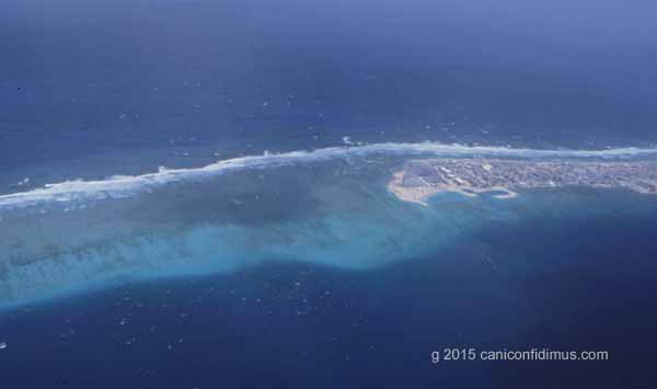
Here is another I took on the same flight.
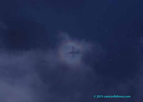
This is a glory. This is not an especially good example, but any example of a glory is a wonder. A glory is a bright ring that forms around the shadow of an observer when the sun is behind the observer and the observer looks towards his own shadow. Glories can often be seen from airliners flying over clouds, or in fog with bright lights behind the observer. I showed a glory in fog in a previous post, although I didn’t actually identify it as a glory. You might also see a glory in smoke.
The Wikipedia article on glories indicates that there is some scientific uncertainty about the source of the phenomenon, but other sources indicate a fairly simple explanation that I think is accurate. It is basically caused by scattering of light by cloud drops or other particles in the air. In the case of most particles or droplets, most of the light that interacts with them is scattered in the same general direction as it was originally traveling. That’s why, when clouds cover the sun or moon, you can see a bright area around where the sun or moon is, as long as the clouds aren’t thick enough to completely block the light. However, a large portion of the incident light is scattered back towards the source. That’s what causes the bright ring around the observer’s shadow. Back scattering, as it’s known, is what makes it hard to see in thick fog if you use your car’s high beams.
The (relatively) simple explanation is also consistent with the fact that you can see a similar phenomenon on a sunny day if you look at your shadow on the ground. There should be a brighter area on the ground surrounding your shadow. That bright area is light that is preferentially scatted back towards the light source.
The Wikipedia article about Kwajalein Atoll has at least one mistake. It says that the total area of the atoll islands is about 16 square miles, when it is, in fact, about six square miles. They may have been referring to the total area of the Marshal Islands, which includes other atolls.
The Marshall Islands are probably most famous as the site of a lot of the US atmospheric nuclear weapon testing.
Kwajalein Atoll is now used by the US Army as a missile and missile defense test site. The current name of the site is the Ronald Reagan Ballistic Missile Defense Test Site (usually called simply the Reagan Test Site, or RTS), named in honor of President Ronald Reagan because of his pursuit of the fantasy of a defense against a large-scale missile attack on the United States.
More than 70 years ago, in 1944, US forces invaded Kwajalein and Roi-Namur as part of the strategy of island-hopping across Pacific on the way to the Japanese homeland. Kwajalein was invaded a few months after Tarawa, which was the first really bloody lesson the US learned about what fighting the Japanese would be like. The planners for the Tarawa invasion thought they had bombed and shelled the island so much that there would be little resistance; that turned out not to be the case. So when they planned the amphibious invasion of Kwajalein, by one estimate, they poured about 6000 tons of bombs and shells onto the island. That’s equivalent to about 40 percent of the size of the atomic bomb dropped on Hiroshima. Another estimate was that it amounted to about 100 pounds of explosives per square foot of the island.
The battle for Kwajalein Island lasted four days. It’s pretty amazing to think about, especially if you have actually visited that island. At almost any point it’s possible to see the ocean on both sides at the same time. Back then I was still running; it was an easy run around the entire perimeter of the island.
The invasion of Roi-Namur occurred next. That island is tiny, even in comparison to Kwajalein Island. That battle took a day. As a result of that 24 hours of fighting, four Medals of Honor were awarded.
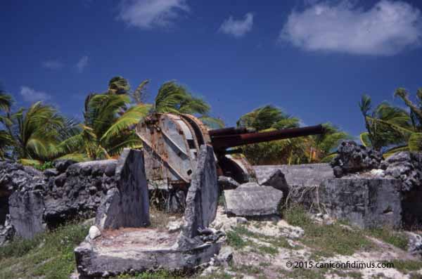
There are quite a few relics from the Japanese occupation and the US invasion. Here is a Japanese headquarters building.

This is what’s left of one of the Japanese defense positions.
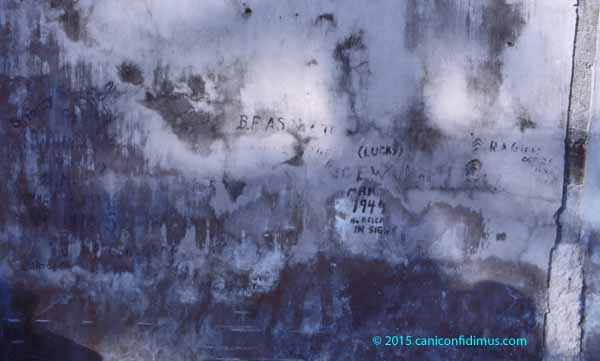
This is a wall of a building with graffiti left from that time.
This is some of the debris left from US equipment lost on the beach. I found some old rifle cartridges in the water near Roi, but have long since lost them.
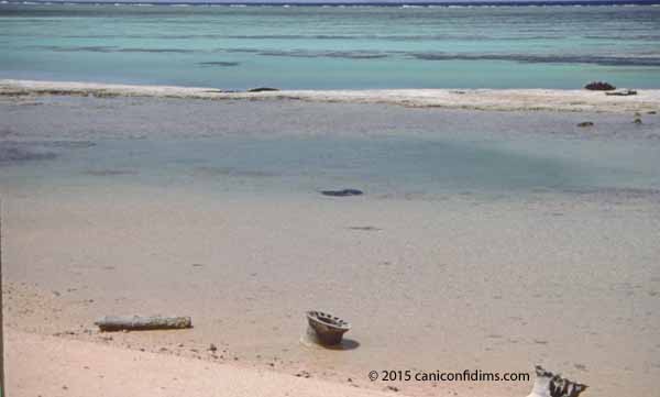
Today, the islands are pretty.
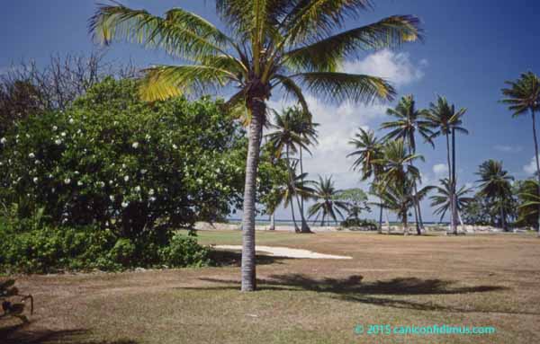
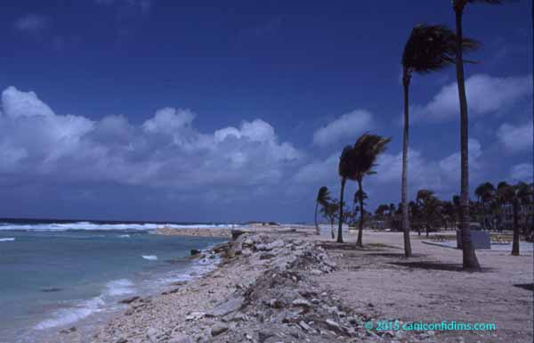
Base personnel cut the coconuts down from the trees to keep them from falling onto the heads of residents.
It’s not what you think of as a tropical paradise, but that image probably comes from volcanic island rather than coral atolls. Coral atolls have no mountains. The highest natural elevation on Kwajalein is probably less than six feet above mean sea level. Fortunately for Kwajalein, it is close enough to the equator that hurricanes almost never hit the island. However, when I was there, a strong storm had only recently hit the islands, resulting in a lot of losses for the Marshallese. Kwajalein’s and Roi’s facilities weren’t harmed, but those facilities are American and more sturdily built.
Kwajalein Island and Roi-Namur Island are reserved for US personnel. Any Marshallese working on the islands must return back to their home islands after each work day.
The reason US personnel are at USAKA is to take part in US missile testing. US intercontinental missiles are sometimes launched from the coast of California to reenter at Kwajalein as part of routine testing of US offensive weapons. Personnel at Kwaj also take part in missile defense testing. This is used for both purposes.
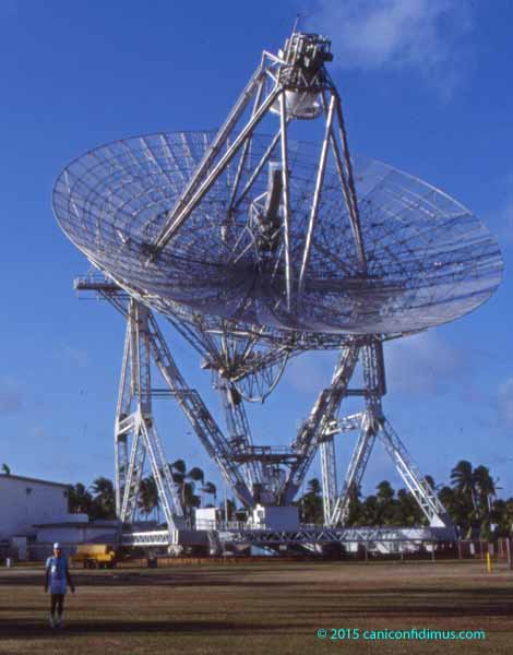
This is ALTAIR (ARPA Long-Range Tracking and Instrumentation Radar), operated by MIT Lincoln Laboratory. ARPA is the Advanced Research Projects Agency, which is currently called the Defense Advanced Research Projects Agency, or DARPA. There are other radars located around the islands.
My visit was part of a small sounding rocket test associated with the old Ballistic Missile Defense program, the one that was going to protect the US from a massive Soviet missile attack. I flew into Kwaj one day and then flew with a few of my fellow contractors and some government workers to the island of Roi-Namur. I stayed at Roi for a few days before the missile test I was involved with. It was a nice vacation. I spent it walking around the island, reef walking and taking photographs (the slides from which the images here are scanned). The weather was warm and humid but reasonably pleasant. The facilities on the island are pretty primitive in some respects. It was at Roi that I learned that if you don’t keep Diet Coke cool, the Aspartame in it breaks down into something that doesn’t taste very good. At all.
Our test, which was a small one, failed. It involved what’s called a sounding rocket, which is a smallish missile that barely reaches outer space and then returns. Our missile had three stages. When the first stage separated, it “chuffed” (residual propellant ignited and puffed out). When it chuffed, the first stage bumped into the second stage and damaged it. The missile then went out of control and had to be destroyed.
So we packed up and went back home, and I never went back again.
![]() It was like this from horizon to horizon. It was impossible to get the entire sky in the picture. I tried a panorama, but that didn’t work. By the time I took the dogs out for their long walk, the sky was almost entirely clear.
It was like this from horizon to horizon. It was impossible to get the entire sky in the picture. I tried a panorama, but that didn’t work. By the time I took the dogs out for their long walk, the sky was almost entirely clear.