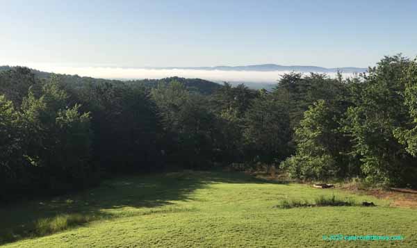
We had a strong but short thunderstorm Tuesday afternoon. A cold front moved through shortly after. When I got up Wednesday morning and looked out the front, this is what I saw.

At first I thought the fog was over the river, but then I realized that the Coosa River runs on the other side of the ridge just beyond the fog. This was not advection fog, this was radiation fog.
Radiation fog forms when the ground cools on a clear, calm night, causing moisture in the air to condense into fog. On Tuesday night, there was plenty of moisture in the air because of the shower, and the skies cleared with the passage of the cold front. Perfect conditions for forming fog. The fog also defines a temperature inversion, where the surface temperature is cool and the temperature actually goes up as you go up in altitude, the reverse of the normal conditions at the surface.
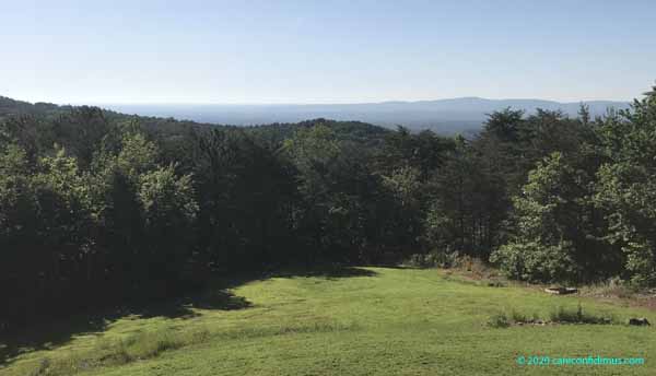
I took the photo above at around 8:20. By 9:30, this is what it looked like.

The for was gone. The bright sun had warmed the surface enough to erode the inversion, and the fog had cleared.
We see radiation fog here fairly often. Sometimes it’s far in the distance like what you photographed, and sometimes it’s right there in the pastures we’re walking by. It’s so cool.
Robin — Radiation fog is pretty common here, too. We see everything from a thick blanket to patchy wisps on many mornings.